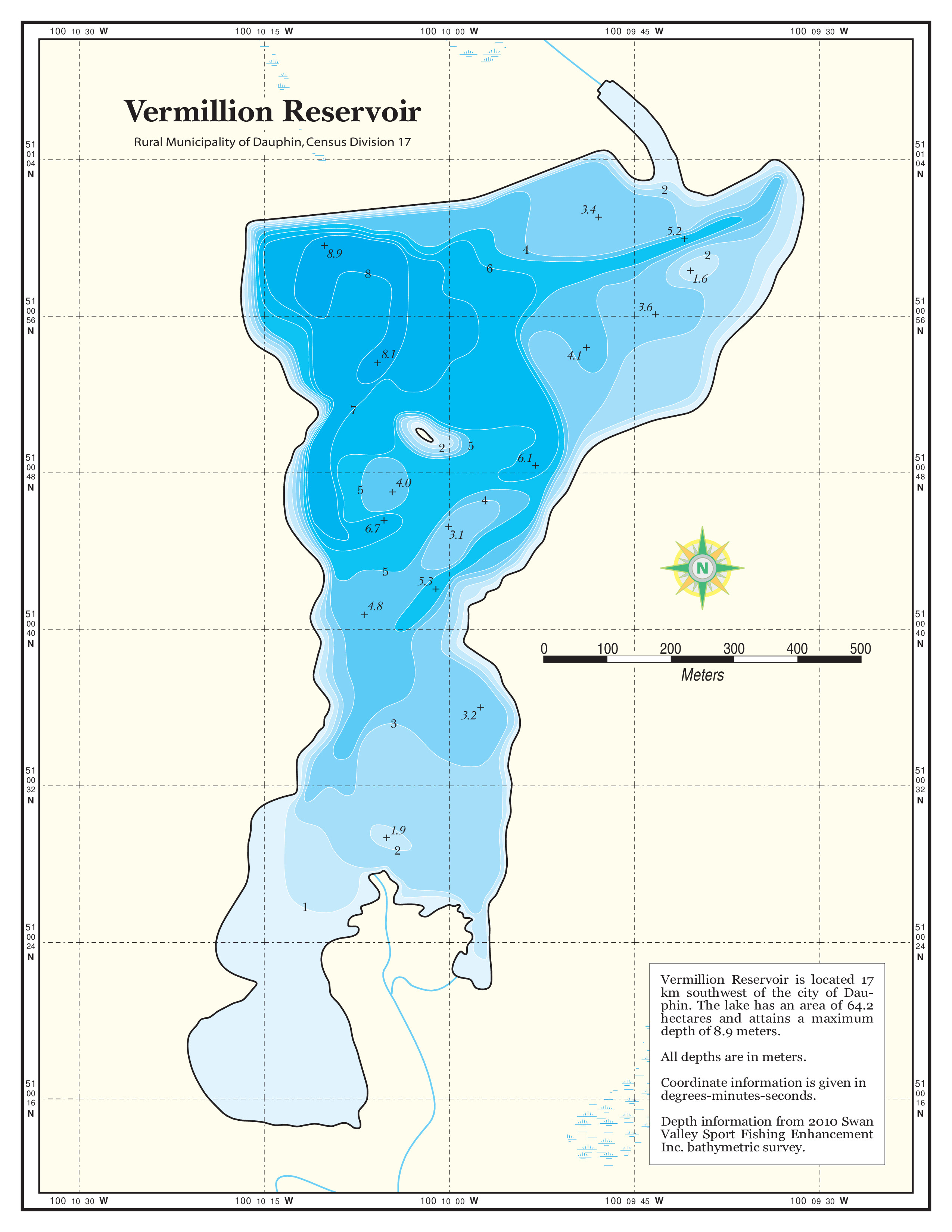
Vermilion Reservoir
The Vermilion Reservoir is 64.2 hectares with a maximum depth of 8.9 meters (depths collected as per 2010 water levels). The reservoir is water retention flood control structure at the upper reaches of the Vermilion River north of the Riding Mountain National Park. Features present include an undeveloped boat launch area, informative signage and parking. Targetable fish species present include smallmouth bass and walleye. Boat motors are limited to electric motor only. CAUTION: Due to the reservoir being a flood control structure, current water depths are prone to change rapidly. Please contact The City of Dauphin for further information. Anglers can find trophy smallies here with very little angling pressure. Try using “bass poppers” and experience the fight of these feisty fish.
Access
From Sticky’s Bait and Tackle shop in Dauphin, follow Highway 10 South 9.2 km and turn west on 139 RD N. Travel 1.6 km and turn left at RD 112. Continue 4.8 km RD 112, as it becomes into RD 138 N. Turn left at RD 114 W for 1.6 km and turn right onto RD 137 N. Continue 1.6 km and turn left at RD 115 W. Continue on Rd 155 W for approximately 2.2 km. The road will end at the boat launch area access point of the Reservoir.